Quoting in SolarPlus just got easier and cheaper with six map options including the industry-leading Nearmap imagery offered at an accessible pay-per-site plan.
Good map imagery makes for better solar sales conversions and a challenge for some is finding the right balance between quality and value for money.
SolarPlus has now launched a pay-per-site Nearmap imagery option to enhance quotes where desirable.
SolarPlus has a policy of being brand agnostic so that users have the choice of whatever products they choose, whether that is components for system design or for complementary services such as quote payment finance and, of course, mapping.
Many state map imagery solutions come pre-loaded including Queensland Globe, NSW Six Maps, SA Maps and while the capture may not be recent the coverage is broad so is often a great option in regional areas.
MetroMap imagery now has extensive coverage, a very reasonable capture program for imagery updates, and high image resolution with good colour enhancement to make presentations look sharp.
MetroMap is available as a subscription bundle with SolarPlus for excellent map imagery and coverage with unlimited map data.
MetroMap’s unlimited data plan means you can search through capture history for the best time of day, while checking shade issues using the capture at different times of the day.
Compared to the data usage limits of Nearmap plans, this bundle is popular with businesses seeking to increase their residential solar quote numbers without facing high charges for premium plan upgrades.
Add to this the option for pay-per-site Nearmap imagery and you have the best of both worlds. The best quality when you need it without paying a premium for the service.
Nearmap offers the best currency with their capture program allowing for quoting on new builds soon after completion.
See a coverage comparison:
Nearmap coverage map.
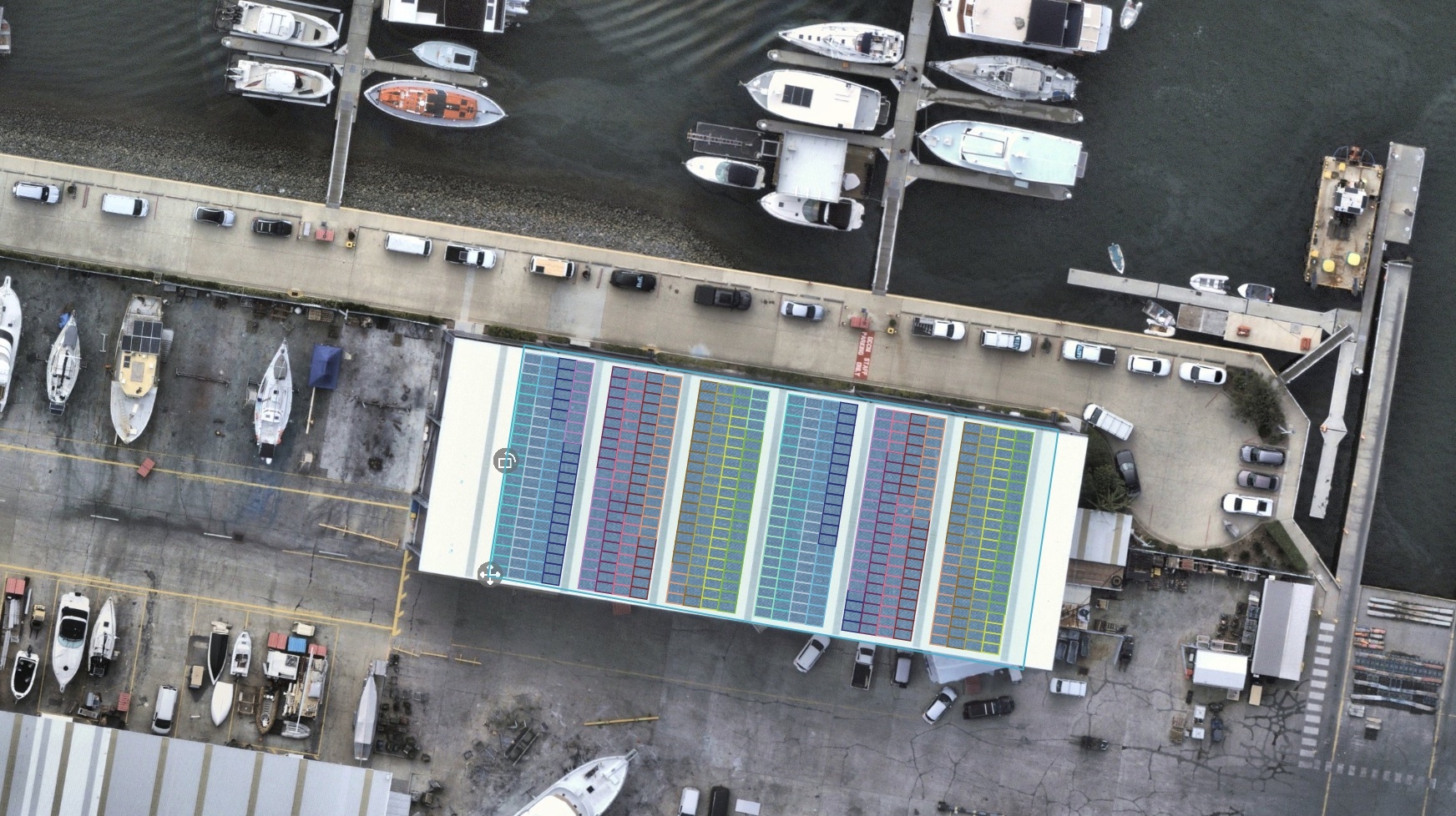
For commercial and industrial solar roof design, Nearmap offers unparalleled imagery resolution down to 5.5cm to help reveal details such as rooftop obstructions, laserlight, and roof cladding materials
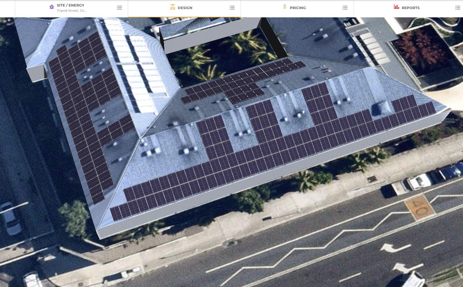
High spatial accuracy and true photo, or top-down imagery is critical to accurate rooftop measurement for panel layout you can rely on. No-one wants to find that panels don’t fit at the time of installation.
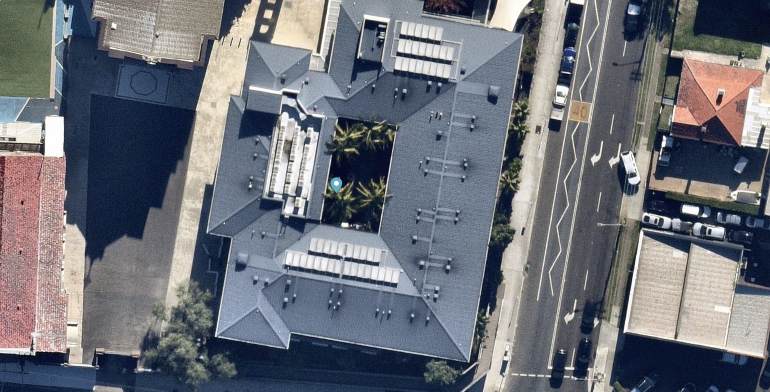
With coverage over 95% of the Australian population, Nearmap imagery can often fill in the blanks when MetroMap doesn’t have the coverage or the required currency.
With SolarPlus you always have the option of bringing your own imagery. Any map imagery, for example state maps like Queensland Globe that have a more recent version on their web browser, can be downloaded and easily updated to SolarPlus for quoting.
Your own drone imagery can similarly be uploaded and quickly scaled by linking three similar points on the imagery.
Building plans can also be uploaded with easy ways to set the overlay size based on drafted plan scale and rotate to suit.
Coming from a background of designing and installing solar systems, the SolarPlus team are well-aware of how important quality mapping imagery is for creating high-quality proposals that convert to sales. It’s the reason we have worked hard to ensure the SolarPlus software offers a range of different mapping options at a variety of price points.
See the full range of SolarPlus features here.